Map & Globe Skills
The ability to properly read maps and globes gives you an opportunity to explore different places, people, and cultures in the real world. These resources, teaching tips, and ideas will help make it easy for your children to learn to read and understand maps and globes.
Activities & Experiments
Postcard Kids
Geography Postcard Kids Project started for homeschooled children around the world in October of 2002. It is intended to help enhance geographic studies by sending postcards from their local area to other postcard kids around the world.

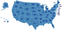
Great States Board Game
What is the capital of NJ? Where is the Football Hall of Fame? These are just a few of the hundreds of questions players are asked as they adventure around the USA discovering state attractions and landmarks, capitals, state abbreviations, state locations and more. In order to answer the questions on the cards, players must look closely at the colorful USA map game board, becoming familiar with the geography of the country. Players must hurry to find the answers as the mechanical timer ticks. Contents: Game board, 100 Figure cards, 100 Fact cards, 100 Find cards, 1 spinner, 1 mechanical timer, and game rules. Duration of Play: 20 minutes. 2-6 players.

Name That Country Game
"Dear Pen Pal, Konnichi wa! We've been to see Mt. Fuji. Name my country! Sayonara, Michiko." Challenge your group with this fast-paced geography game, created in 1992 by Educational Insights, Inc. Everyone begins at the post office. Players twirl a finely printed spinner (built into the game board itself) to select one of 60 countries. If the player can correctly identify the country's location on the board's numbered map, he or she may advance along the path to the finish. Bonus moves are won by landing on "postcard" spaces, listening to the clues on one of the 40 postcards, and correctly identifying the pen pal's country. (The sample postcard above came from Japan.) A more challenging game can be achieved by requiring players to name the country's capital; answers are provided. --Liane Thomas
Teaching Tips & Ideas
Knowledge Quest
Knowledge Quest offers historical outline maps and timelines designed for the interactive study of world history and geography.
How I Teach a Large Family in a Relaxed, Classical Way: History
A look at teaching history across several grades using the classical method of education and a rotation of history every four years.
Looking for Another State?
Featured Resources
As an Amazon Associate, we earn from qualifying purchases. We get commissions for purchases made through links on this site.

Montessori Life
Designed to provoke thought, professional growth and provide a forum for discussion of major issues & ideas in education.

But What About Socialization? Answering the Perpetual Home Schooling Question: A Review of the Literature
This book by Dr. Susan A. McDowell uses research, statistics, and the experiences of homeschooling families to answer questions and counter myths about homeschooling and socialization. Read through a discussion of the multiple meanings of socialization, what parents, leaders, and children have to say about the issue, and what the research shows.

Kids' Poems (Grades 1)
Regie Routman shares her delightful selection of free verse poems written by first graders that will inspire your second graders to think, I can write poems like this too! Regie provides strategies for using kids' poems as models to guide children to write poems about things they know and care about: learning to skate, disliking asparagus, playing with a best friend, and more. She describes the way she invites children to study the model poem, beginning by asking kids, What do you notice? She sh...

Please Don't Drink the Holy Water
Susie Lloyd faces the trials and joy of raising a happy, active Catholic family.

Consider This: Charlotte Mason and the Classical Tradition
The educators of ancient Greece and Rome gave the world a vision of what education should be. The medieval and Renaissance teachers valued their insights and lofty goals. Christian educators such as Augustine, Erasmus, Milton, and Comenius drew from the teaching of Plato, Aristotle, and Quintilian those truths which they found universal and potent. Charlotte Mason developed her own philosophy of education from the riches of the past, not accidentally but purposefully. She and the other founding...